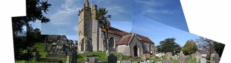
Timeline of Worle from 1940 to 2022
Our Chairman, Dave Hart has created this wonderful new treasure. If you have suggestions for additions, please email Dave. You'll find his email address on our Committee Page.
Worle Timeline from the ‘50s
(Amendments and Additions Welcomed)
At the beginning of Queen Elizabeth’s reign in 1952, Worle was a very small village on the outskirts of Weston surrounded by some very marshy countryside. The village was named in William the Conqueror’s Domesday Book in 1086, so Worle has been here for well over 1,000 years.
What has changed?
Houses and Housing:
Many of the houses were hundreds of years old and lacked the facilities that we expect to be
in houses today; central heating, fitted kitchens, bathrooms & toilets, driveways & garages.
Some of the old buildings were re-purposed or modernised, others were demolished.
Schools and Schooling
Grammar schools, Secondary Moderns and Comprehensive schools have gone, and so have
junior & infant schools, to be replaced by academies and primary schools. All new schools
now have playing fields.
Transport and Travel
The rise in private car ownership has caused motorways and dual carriageway roads to be
built, and many old roads widened. Railway Stations have closed and opened. Bus travel
has come and gone. Small petrol filling stations have closed in favour those at supermarkets.
Food Production
Local and seasonal produce has been replaced by national and international produce
available all the year round. Allotments, market gardens, local farms and orchards have
mostly disappeared, and private gardens are now too small to grow your own vegitables.
Shopping
Supermarkets and out-of-town shopping centres have caused most small shops to close.
Leisure time & Public Open Spaces
With the disappearance of local farmer’s fields under housing, public open spaces have had
to be created, including school playing fields, public parks with leisure and play equipment,
cycle ways, footpaths, and many other traffic free areas.
Commuting
People now travel longer distances to find work using private and public transport.
Reclaimed land for housing has necessitated flood prevention measures which must be maintained.
What was Worle like in the 1940s?
1938. Alms Houses [only one toilet for 6 houses] in the Scaurs demolished and replaced with an air raid shelter.
1939 – 1945 World War II: Seven people died in Worle, including David Jones, 38, Janet Jones, 33,
and Valery Jones, 3, at “Westonia” in High Street on 4th September 1940. Melville Jones, 8, was
blown out onto the forecourt of the Golden Lion but survived. Charles Drury, 64, died at East Lynch, Ebdon Road, on 28 th June 1942. Bombs exploded in Greenwood Road, Hill Road East and at the bottom
of the Scaurs opposite the New Inn (now the closed Woodspring Pub), where Basil James and William Wheeler died. Private Jack Raines was accidentally shot while on duty with the Home Guard in the
Observatory on Worle Hill. An unexploded bomb fell where Cherrywood Road is now and was defused by the army. Some of the Bomb damage was still visible until the late 1960s.
1940 Worle County Secondary opened in Spring Hill. It was for pupils aged 11 to 15, and most left
as soon as they were 15 even if they were still in the 4 th year. Further education beyond age
15 was only to be had at Weston Grammar School near Uphill.
To add authenticity to domestic science classes, which were only open for girls, Worle
School had what was known as The Flat. There was a bedroom, bathroom, lounge and
kitchen each fully fitted out like a normal home. For five days, two girls at a time were
expected to spend their school hours cleaning the flat, cooking all their meals and washing
bed linen, and so on. They would also entertain friends and staff, including the Headmaster.
While girls were learning to run a home, the boys were taught metal work, woodwork and
gardening, the latter a reminder of the war years when food production was so important.
Part of the school grounds were turned into a vegetable garden, with the produce used in
the school kitchens. (At this time most women stayed at home to look after the family.)
In the dark winter months, Walter Hartree and his sister would walk to school from
“Stonycroft” house on Worle Hill through fields and down stony paths using a hurricane
lamp to light the way. Walter’s job at home when he was a boy was to collect water from a
tap at the top of Milton Hill using a donkey cart.
1940 Weston, Clevedon & Portishead (WC&P) Light Railway closed with its station in Station Road.
1943: All the steel rails from the Weston, Clevedon & Portishead Railway were removed to benefit
the war effort.
1946 16 Prefabricated houses built on the Malting’s field for people made homeless by war
damage.
1950 An old mine shaft, revealed near the Old king’s Head on the Scaurs, shows that mining for
calamine (an ore of zinc used to make brass) used to be a major Worle industry, and
probably gives the origin of the road’s name (from “score”- a line or “scour”-to clear out .. a
vein of calamine).
1953 The No. 40 bus from Weston terminates outside the New Inn which is where the village
ended.
There was a Royal Heritage Pageant produced by Worle Junior School.
The Coronation of H. M. Queen Elizabeth II was on Tuesday 2 nd June. A fair and sports were
held on Tripps Field, High Street, and 500 children assembled in a marquee for tea and
singing. (High Street was known as Lower Street and Bristol Road until it was renamed High
Street in 1928)
There were complaints from people living on Locking Road and New Bristol Road about the
smell caused by Forsey’s lorries carrying offal (waste food) from the hotels on the sea front
to the piggery on Rickett’s Lane in Worle, to feed the pigs. Burning offal smells were also
complained about in Worle Village but no action was taken.
Ivy Lodge was a Guest House and Cafe, later becoming an Old People’s Home and then a
private home.
Many cottages in Lawrence Road were condemned as being uninhabitable. The cottages all
shared one toilet (privy) out in the yard. They were demolished and bungalows were built in
their place.
1954: Castle Batch registered as a Scheduled Ancient Monument as a Motte Castle possibly
occupied from 11 th to the 13 centuries.
(Late 50s) Captain Batiscombe’s house on Church Road opposite St Martin’s Church demolished to make way for housing. Houses were built in fields to the south side of Spring Hill, opposite Worle
Secondary Modern School. These had been green fields (the “green wedge”) which were protected to separate Worle from Milton, however in the Council’s latest development plan it was seen as no great
loss. They also turned down its use as a sports field for the Secondary Modern
School.
The spring from which Spring Hill gets its name now disappears in pipe work.
1955 Mr Sage buys the Observatory, a former windmill, with the intention of using the land to
extend Worle’s quarry. The extension was not allowed.
1956? Worle Secondary Modern School “flat” made into extra classrooms (art room), indicating a
change in domestic Science thinking and the teaching of girls.
“Ashlyn Nurseries”, between Coronation Road and Hill Road, sold for housing. (Martin’s
Grove)
Late 1950s Ferguson Tractors were introduced indicating a change from horse powered
implements to the mechanisation of farming. (Farm tractors first started to appear
during WWII.)
1959 Manor House Farm, Spring Hill, was sold. A builder bought the land while Percy Staples
bought the farm building and set up Staples Dairies. The cows would soon go too!
1960
Court Farm was demolished on Ebdon Road and Madam Lane bungalows built.
4 “Stonycroft” house on Worle hill was finally connected to water and electricity supplies.
1962 Construction of Ebdon Road Cemetery and Crematorium.
Vale Mill, an old windmill, was burnt down by vandals, after which the building was
converted into a private home.
1963-4: Manor House Farm housing estate was built on farm land on Church Road and the Weind.
Church Road was widened to cater for the extra traffic. All the houses now have garages and
space for parking cars, as car ownership was rapidly increasing.
New houses are built on Hawthorn Hill.
A light plane crashed on Worle Hill by the Observatory. The occupants were rescued by
golfers but no one was seriously hurt.
1964 Puxton &; Worle Station closed. Fewer people were using the railways in favour of private
cars. Less freight was being carried on the railways due to road transport being more
convenient.
The closure of the “Strawberry Line” railway from Yatton through to Wells.
The closure of the railway line from Yatton to Clevedon.
An article in the Bristol Evening Post of 14 th April indicates the planned scale of the
development for the area:
“Worle, the former village at the Bristol end of Weston-super-Mare will double in the next
five years. Of 1,164 homes to be built in the town during that time, 1,055 will be in the Worle
area.” Much of the development would take place in the Church Road area.
“East Lynch” off Ebdon Road and Hollow Lane, is sold for housing
1964-5 Nutwell Farm on High Street is sold and houses are built on Nutwell Road & Rycroft Avenue by Mendip Green School. Nutwell farmhouse becomes a care home for older
people.
1965 Church Farm, Church Road and 4 acres of land is sold for housing. The farm house was
demolished. North Worle now starts to be built on.
1966 Commencement of the Prean’s Green housing estate on Tavistock Road, Tamar Road &
Bideford Road.
Rickett’s Lane is widened to form Tavistock Road.
Church Road widened near St Martin’s Church.
Rickett’s Lane piggery is now a storage warehouse for the Bristol Aero Engine Company to
store engine spares owned by the Ministry of Defence.
1968 Rhynedale housing estate is built over part of the WC&P track bed and sidings and
allotments. Mendip Avenue is extended, and new roads Copley Gardens, Cotman Walk, etc
are built. White House Farm in Station Road is demolished and Knightstone Housing offices built.
The Congresbury Yeo river overflowed its banks, flooding large areas and blocking the road
to Bristol. The storm also flooded parts of Worle.
Preane’s Green House demolished. Ebden Lodge sheltered housing is built on the site. The “prefabs” are removed and Worle Library (now Sweets & Things), houses, Lloyd’s Bank
and shops built, partly on land that had been a bomb site since 1942.
The opportunity was taken to straighten and widen High Street at the bottom of the Scaurs.
1969 House building starting on the west end of Worle hillside (Balmoral Way, Penrice Close) on
land that was formerly market gardens. The market gardens were no longer economical.
Workers expected higher pay than was on offer for this work. (Agricultural wages for school
leavers in the 1960s was £4.40 per week whereas in industry it was £7.22 per week, making
it harder for the market gardeners to find labour.)
The building of Mendip Green School started on fields that were part of Mr Tripp’s Nutwell
Farm.
The part of Madam Rhyne in Tripp’s fields is now buried in a culvert.
1968 – 1973 M5 Motorway and Junction 21 are built giving fast travel to all parts of the country.
It was built on fly ash from Port Talbot steel works as a stone base would have been
too heavy, sinking slowly into the marsh lands around Worle. The access roads were
all widened to cater for the extra traffic.
1973 Great Britain joined the European Economic Community, bringing in more stringent
rules and regulations on growing, packaging and paperwork which caused many
small agricultural producers in the village to close down.
“Furlands Nurseries”, the last market garden, was finally sold for housing.
1971 – 76 The Worle Hill market gardens are now completely built over with the completion of
Balmoral Way, Whittington Drive, Wigmore Gardens, Pleshey Close, etc.
1971: Worle Comprehensive School opened. This is not just a new school for the increasing
number of children in Worle but also a change in the type of education. Grammar Schools
were closed, becoming Comprehensive Schools, and the new schools catered for all student
abilities. A large area of playing fields is created around the school.
Worle Secondary Modern in Spring Hill became St Martin’s Junior School, teaching pupils
from aged 8 to 11. Mendip Green and Hillside Schools are for infants only, aged from 5 to 7.
Early 1970s: New houses are built on Mead Vale (Bird Land), and also Pilgrim’s Way &; Torminton
Road off Kewstoke Road
1973 The Old Forge at the top of Hollow Lane is demolished for road widening.
New houses, built by Second City, are opened in Madam Lane.
Nut Tree Farm in Ebdon Road is used as offices by the house builders.
Manor House Farm farmyard, Spring Hill, is sold for housing (Deacon’s Close). Romano-
British remains were found in the area showing that people had lived there for over 2,000
years.
1975 Wick St Lawrence Sewage Treatment Works near the Congresbury Yeo River was
commissioned.
1976 A Conservation Area Study took place in old Worle along Church Road, Lawrence Road and
the Scaurs.
Mid 1970s: Verbina Way and houses to the east of Moor Lane were largely completed by 1980.
Houses are built along and off Silverberry Road on land where the Worle Flower
Show used to be held before it moved to the Recreation Ground. The first phase of
properties in Coralberry Drive was completed in September / October 1977.
The Gateway Supermarket opened on High Street where there used to be Nook
Farm and Greenwood cottages, which later became Somerfield and then The Co-op.
Key Supermarket opened on High Street, which later became Properjob, and HSBC
and Barclays Banks.
Worle Health Centre was built in the apple orchard by St Martin’s Church cemetery.
Nut Tree Farm becomes a public house and restaurant.
Laurel Farm Caravan Park in Station Road is closed and a small housing estate built.
1977: The opening of North Worle District Centre, Sainsbury’s, is the first big supermarket in the
Worle area signifying a change in the way we shop. It caused the closure of many small
shops in the village (bakeries, grocers, etc.). The Sainsbury’s petrol station, selling cheaper
petrol, caused many small local petrol filling stations to close. (Central Garage in Worle
High Street, and three others on New Bristol Road.)
Business Centre behind Sainsbury’s opened.
As people had to travel to the out-of-town shopping centres, car parks were an essential
part of the plan.
A large do-it-yourself shop was also built at the centre (Sandford’s) indicating that more
and more people were starting to do building and decorating themselves. This again
caused local ironmongers shops to close.
Part culverting of Grumbepill Rhyne took place, which passed under Sainsburys.
The opening of the Queensway (Queen’s Way) primary distributor road, Bristol Road to
Ebdon Road, named after Queen Elizabeth II silver jubilee of 1977.
Street parties were held all over Worle to celebrate the Queen’s silver jubilee.
The Silver Jubilee Tour of Queen Elizabrth II and Prince Philip visited Weston on Monday 8 th
August, stopping on the Beach Lawns to meet local people. The Royal Party left at 4.30 pm
and drove past Worle on their way to Avonmouth and H.M. Yacht Britannia.
Priory Comprehensive School opened with playing fields and sports areas.
Manor House Farm farmhouse, Spring Hill, is sold and becomes a Guest House.
The first bus (106) to use Ebdon Road & Queensway was now running.
1978 The completion of culverting of Madam Rhyne to its outlet on the River Banwell took place.
The North Worle Surface Water pumping station was commissioned.
1979: The diversion and part culverting of Lyfield Rhyne near Ebdon Road and St Mark’s Road was completed.
The Imperial Laundry in the old brewery in High Street was closed after about 100 years of
operation. (Opened in 1879)
The opening of the Queensway primary distributer road, west of Ebdon Road to Lower
Norton Lane took place. The development of houses along Becket Road and Wansborough
Road is now well underway.
Unwanted earth from the building of The Queensway was used to fill in Lynch Farm Quarry
by Ebdon Road. Lynch Farm fields become a public open space.
Madam Lane becomes a footpath and cycleway.
Castle Batch becomes a public open space.
1980 Manor Farm, Queensway, is converted into an inn and hotel.
1981 St Mark’s Church was opened.
Lawrence Road Methodist Church is closed and the Ecumenical Parish of Worle set up. The
Methodist Chapel becomes a community centre for the people of Worle.
St Mark’s Road telephone exchange is commissioned.
A tidal surge flooded Uphill prompting work to raise the sea walls from Uphill to Clevedon.
1982 St Mark’s primary School is opened.
Neathway’s Bakery on High Street is sold and shops built.
St Martin’s vicarage on Church Road is demolished and new flats built.
Public open spaces are created at Lynch Farm and Castle Batch.
1985 Castle Batch Primary School is opened.
Worle General Stores in Manchester Square, Church Road, is closed and converted into
housing.
1986 Weston General Hospital in Weston town centre closed. Worle people now have to go to
the new hospital at Uphill. They nearly built the new hospital in Worle but were worried
about the vibrations caused by trains on the railway line. It would have been much more
sensible to have had the hospital near the motorway.
? Becket Primary School opened (1996?).
1989 Walford Avenue local distributor road from Becket Road was commenced.
A new riverside walk along the banks of the River Banwell was started.
A public open space from Priory School to the River Banwell was created, also serving as a
flood plain in times of heavy rain.
1990: Worle’s fourth station, Worle Parkway, opened, but only for three coach trains, indicating
that more people are again wishing to travel by train as the roads and motorways become
choked with traffic. Worle Parkway Business Centre is opened adjacent to the railway
station.
1994 The A370 dual carriageway is built from Junction 21 to Weston with access roads to Worle.
The Grumblepill Rhyne is diverted alongside the dual carriageway to flow towards Uphill.
The cottages in Sprake’s Terrace, Station Road, are closed up.
1996 Mr Smith’s Shoe Shop in the Parade, High Street, is closed when he retired.
2000 The linking through of Walford Avenue local distributor road to the St George’s
developments is completed.
2002 Queensway East is diverted around Priory School and a new junction with New Bristol Road
constructed.
Military explosives are lost off St Thomas’s Head, Sand Bay.
2003 The Homebase Store, McDonald’s and Argos near Priory School are opened.
Worle Baptist Church, Rawlings Avenue
2004 Worle Brewery / Imperial Laundry building demolished on High Street and flats built.
The Campus Community Centre is built.
? Locking Castle District Centre is built, including Morrison’s supermarket, Boots, Matalan, etc.
2003 – 2006 The Development of housing in Locking Castle, Wick St Lawrence, St George’s and
Weston Village takes place.
Plumley Park is created with cycle ways and lakes alongside the railway line.
2005 Fussell’s Rubber Factory and cottages in Station Road are demolished. Fussell’s Court is built on the same site.
The WC&P Worle Station footpath on Station Road is opened.
2007 Weston Courthouse at St Georges is opened.
2009: (July) The official opening of the Milton and Old Worle Children’s Centre takes place in what was the site of Mendip Green School in Mendip Avenue, securing the building from
being
sold for housing.
2010: Worle now has many bus services including 3, 5, 7 & 14 terminating at Sainsbury’s.
2007 – 2012: There are housing developments at West Wick and along Wolvershill Road towards
Banwell.
2011 Priory School becomes an Academy Trust.
2012: There is large scale flooding around Plumley Park and Morrisons but no houses are
damaged.
2012 – 2014: There are road improvements to Junction 21, extra parking at Worle Parkway Statio
and Weston Gateway developments by Junction 21 take place.
2015?: Worle Library in the Maltings is closed and transfered to the Children’s Centre in
Mendip Avenue (the old School building).
A new Weston Police Station is opened by Worle railway station.
The dikes are raised by one metre alongside the Congresbury Yeo, near Wick St Lawrence, and from St Thomas Head to Clevedon, to prevent tidal flooding as sea
levels rise.
The Knightstone Housing offices in Station Road are demolished and houses built.
2016: Flood plains are created alongside the River Banwell to reduce the risk of the flooding of
Worle due to heavy rains. The area becomes a public amenity area during dry weather.
Worle Community School (formerly Worle Comprehensive School) joins with Priory
Academy. (Priory is now a Multi-Academy and Priory Learning Trust has 570 staff.)
? The Paula Radcliffe Gym and Fitness Centre is opened at Priory School.
2019: Extra drainage work is completed around Plumley Park and The Campus to reduce the
chance of future flooding in that area.
Barclay’s and HSBC banks are closed, leaving only Lloyds for banking in the village.
The Knightstone Housing offices in Lawrence Road are demolished and Poppy Court built.
“Sweets & Things” takes over the old Library building in the Maltings.
2020: Dr Petty’s House and buildings on Church Road is converted into five new homes.
2021: The Parish of Worle is split up into new separate parishes. Now, it is the Parish of Worle St
Martin’s, etc.
The Woodspring Public House is up for sale with suggested demolition for housing but with a
listed building in its grounds.
2022: The Weston to Clevedon cycleway via Worle, Wick St Lawrence and Kingston Seymour is
promised to be completed along the route of the WC&P light railway.
The No 5 bus to Worle is withdrawn. North Somerset Council appoints Stagecoach to run an
hourly service to replace it.
What ever next. Please let us know.